|
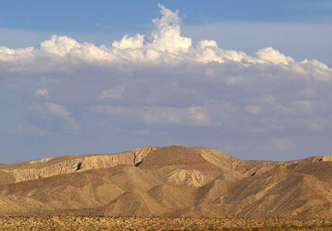
COYOTE MOUNTAINS
ANZA-BORREGO SOUTH Headed south from Scissors Crossing on County Road S-2, you come to the point
where the Southern Emigrant Trail turns eastward while S-2 becomes Sweeney
Pass Road.
This is Anza-Borrego South, the last miles of the state park and the beginning
of government land for military and civilian purposes, dotted with an occasional
village (Ocotillo) or town (El Centro).
To the west, you pass such Tierra Blanca Mountains spots for hiking, birding,
and wildflower watching as Indian Valley (reached
via Indian Gorge), Mountain
Palm Springs, and Bow Willow.
To the east, if you have a 4-wheel drive vehicle, you can follow Vallecito
Creek or Carrizo Creek through country that delights geologists,
paleontologists, spelunkers, and 4-wheel drive enthusiasts.
After crossing Carrizo Creek, the road takes you up Sweeney Pass into the
Coyote Mountains which you can view from the Carrizo
Badlands Overlook. To the west, you'll note the dark soil of the Volcanic
Hills, Anza-Borrego's volcano country, followed by the rocky Jacumba Mountains
which stretch to the Mexican border. You will also pass the Mortero Wash
turnoff which leads to important Native-American sites and the tracks of
the San Diego Arizona & Eastern Railway.
On S-2, Anza-Borrego Desert State Park ends at the San Diego County line.
But the desert continues into Imperial County across the Mexican border and
into Mexico. In the mountains to the west, the state park stretches to or
near Interstate-8 at points as far west as Jacumba. San Diego County goes
down to the Mexican border.
To the east, what we think of as "Anza-Borrego" encompasses the
Coyote Mountains and the Yuha Desert
to the south and east. In fact, for many people, "the desert" stretches
all the way to the Colorado River and Arizona and includes the Salton Sea
and Algodones Dunes.
Major highways across the area include County
Road S-2, Interstate-8, Old
Highway 80, and Highway 98.
|