|
ANZA-BORREGO SOUTH : ROADS County Road S-2
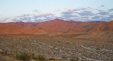
Bow Willow from Egg Mountain — Sombrero Peak in the Distance
In Anza-Borrego South, County Road S-2 is known as the Sweeney Pass Road
from Indian Gorge to the southern border of Anza-Borrego Desert State Park
at the county line, and as the Imperial Highway from the county line through
Ocotillo to Highway 98.
ANZA-BORREGO SOUTH : ROADS Interstate 8
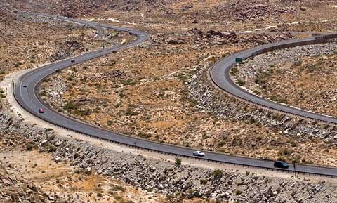
Interstate 8 At Mountain Springs.
traffic heads east Down In-Ko-Pah Gorge
and comes westward up from Devil's Canyon
Area entrances and exits include:
- Jacumba
- Food and gas. Round Mountain.
Old
Highway 80.
- In-Ko-Pah
- Old Highway 80. Table Mountain.
Desert
View Tower. Smugglers Cave. Valley of the Moon.
- Mountain Springs
- Mostly private property.
Stagecoach Station
Ruins. Trails into
Jacumba Mountains.
More.
- Highway 98
- Yuha Desert. Jacumba Mountains Wilderness. Crucifixion Thorns. Signal
Mountain. Calexico. Details.
- Ocotillo
- Food and gas. Old Highway 80 (Evan Hewes Highway).
Shell/Fossil
Canyon. Painted Gorge. Plaster
City OHV Open Area.
- Dunaway Road
- Access to the east side and the rocky north side of Yuha Basin. CAUTION:
The sand in the basin can be deep. More.
- El Centro
- Highway 86
-
-
ANZA-BORREGO SOUTH : ROADS
Highway 80
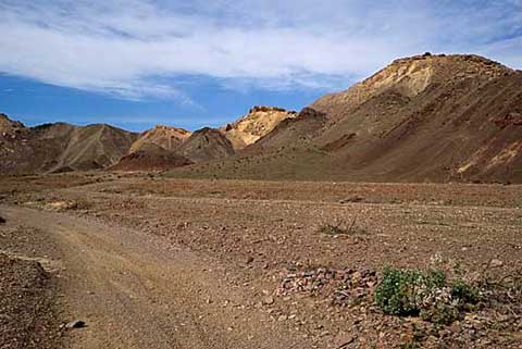
Painted Gorge
Historic Old Highway 80 linked San Diego and Yuma. In San Diego County, it
can be driven from Jacumba to Alpine. Interstate-8 has replaced it from the
In-Ko-Pah on-ramp to Ocotillo, where it is known as the Evan Hewes Highway.
- Jacumba
- Food and gas. Interststate-8.
More.
- In-Ko-Pah
- Interststate-8.
Desert
View Tower. Table Mountain.
Army-Stagecoach
Trail. More.
- Ocotillo
- Food and gas. Painted Gorge.
ANZA-BORREGO SOUTH : ROADS
Highway 98
Highway 98 is a two-line blacktop highway that runs from Ocotillo to Calexico.
Points of interest include:
Clark Drive – Turn south to Davies Valley in the Jacumba
Wilderness.
Coyote One Road(BLM Road EC 274) – Turn north past
the microwave tower to the Yuha Basin and Anza
Monument.
BLM Road EC 282 – Turn south to the
Crucifixion
Thorns area.
Roy's Road– At the edge of Pinto Wash. Stop to
look for wildflowers in season.
Mount Signal Road– At the edge of the desert, just
before the agricultural area. Turn south for a closeup view of
El
Cerro Sentinala.
Calexico – At Imperial East Road (Highway 111),
turn south to the border or north to return to your starting point via Interstate-8,
Highway 78, or Highway 86.
|