Anza-Borrego North: Smoke Tree Wash, Smoke Tree Canyon
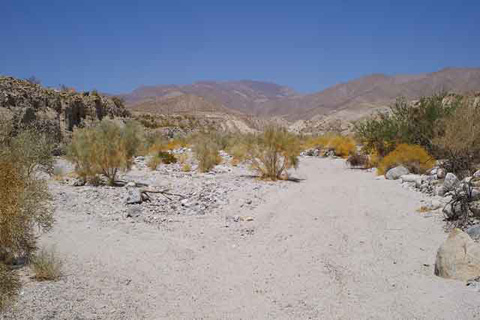
Smoke Tree Wash with Blue-Green Smoke Trees
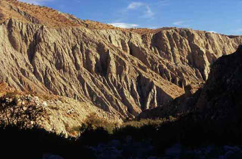
From County Road S-22, you can walk north on Smoke Tree Wash for a little over a mile before the pathway narrows and takes you into Smoke Tree Canyon. Near S-22 are the smoke trees whose deep blue flowers are one of the great spectacles of early summer in Anza-Borrego. As you move forward, the walls of Smoke Tree Canyon come closer and you are treated to some fine scenery. You can see erosion at work.
A group of Natural Rock Tanks (identified as such on the Fonts Point map of the USCGS 7.5-minute series) are located about three miles up the canyon, but unfortunately a large boulder blocks the way. It's possible to climb the boulder, but most hikers choose to get to there from Palo Verde Canyon and perhaps slide down the boulder and leave the area through Smoke Tree Canyon. Carrying the Fonts Point topo map is a good idea.