|
Exploring North:
County Road S2
San Felipe Valley
Historically, the trans-desert route to California by way of the San Felipe
Valley is the third route used by non-Indians. The first was Anza's route
through Coyote Canyon, the second the Fages route through Oriflamme Canyon.
The San Felipe Valley route dates to the 1820s when California was part of
Mexico. Major use ended after the Civil War when a highway and railroad were
built to Los Angeles by way of the Salton Sea, the San Gorgonio Pass, and
what is now Interstate-10.
Today, most of the land along this stretch of County Road S-2 is private
property. From north to south, points of note include: Highway 79,
Warner-Carrillo
Adobe and Butterfield Stage Station, County Road S-22, Teofulio Summit,
San Felipe, San Felipe Valley, Highway 78.
For more on the history of the area, see the articles on Lt. Santiago Argüello,
San Felipe, San Felipe Indian Village, San Felipe Ranch, and San Felipe Stage
Station in Anza-Borrego A to Z by Diana Lindsay.
Exploring North:
County Road S3
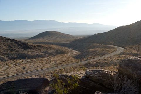
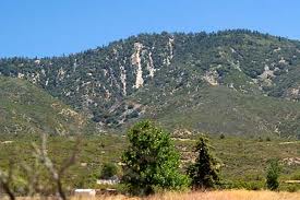
Yaqui Pass Road and Ship Rock with Borrego Valley in the Distance
Twelve miles long, County Road S-3 connects Highway 78 and County Road S-22
at Christmas Circle in Borrego Springs.
Points of interest include Yaqui Well, Tamarisk Grove Campground,
William
L. Kenyon Overlook, Yaqui Ridge, Pinyon Ridge,
Yaqui Pass Campground, Ship Rock, and Glorietta
Canyon.
From Highway 78 to Borrego Springs Road, S-3 is known as Yaqui Pass Road.
From here, Borrego Springs Road continues northwest (as S-3 to Christmas Circle)
and southeast to Highway 78. From Christmas Circle, Borrego Springs Road continues
to Henderson Canyon Road.
Exploring North: County Road S-22
County Road S-22 opened in 1963. Before that time, access to the Borrego
Valley was significantly more difficult. From the west, motorists went from
the Montezuma Valley down the Grapevine Canyon Road and San Felipe Wash (Highway
78) to the Narrows where they turned northwest on what is now the Old Borrego
Valley Road. From the east, motorists used the Truckhaven Trail.
From west to east, S-22 is known locally as follows:
- Montezuma Valley Road
- County Road S-22. Pacific Crest Trail. Ranchita.
Jasper Trail. Culp Valley.
California Riding & Hiking Trail.
Little
Surprise Canyon. Palm Canyon Drive.
- Palm Canyon Drive
- Montezuma Valley Road. Borrego Springs.
Anza-Borrego Desert State Park. Borrego Palm
Canyon. Christmas Circle. County Road S-3.
Henderson Canyon.
Coyote
Canyon. Borrego Springs Airport. Pegleg Road.
- Pegleg Road
- Palm Canyon Drive. Old Springs Road. Pegleg Monument. Coyote Mountain. Borrego-Salton Seaway.
- Borrego-Salton Seaway
- Pegleg Road. Rockhouse Canyon Road (Clark
Valley). Borrego Badlands (Fonts Point).
Palo Verde Wash.
Smoke
Tree Wash. Coachwhip Canyon.
Ella
Wash. Arroyo Salado Wash. Truckhaven
Rocks. Palm Wash.
Calcite
Mine. Truckhaven Trail.
Cannonball
Wash. Ocotillo Wells State Vehicular Recreation
Area. Salton City. Highway 86.
Exploring
North: Highway 79 Highway 79 is a major route to Anza-Borrego from Temecula and points north.
- Temecula
- Interstate 15. Temecula wine country.
- Dripping Springs Campground (US Forest Service)
- Hiking access to Palomar Mountain.
- Aguanga
- Highway 371 leads to Anza, with northern entrances to the state park,
and Highway 74 with access to the Pacific Crest Trail, Toro Peak, and
Santa Rosa Mountain.
- Oak Grove
- Campground maintained by US Forest Service.
More.
- Chihuahua Valley Road
- California Riding & Hiking Trail. Indian Flats Campground. Lost
Valley Road to Anza-Borrego Desert State Park and
Pacific
Crest Trail. Combs Peak.
More
- Sunshine Summit
- Grocery/Hardware store. Cafe.
- Warner Springs
- Airport. Indian
Flats Campground. Pacific Crest Trail.
- San Felipe Valley Road
- County Road S-2 to County Road S-22 and ABDSP.
- Highway 76
- West to the coast by way of Fallbrook and Oceanside.
- Santa Ysabel
- Historic interest. Craft and antiques shopping, market, restaurants,
and bakery. Hiking.
- Julian
- Historic interest. Mines, wineries. Food and gas. Shopping.
Exploring North: Highway 86
Travertine Rock
Highway 86 defines the east side of Anza-Borrego North, from Salton City
north to the Riverside County Line.
On the south edge of Salton City, the road to the county dump can be followed
to Pole Line Road and south into the Ocotillo Wells State Vehicular Recreation
Area. The Truckhaven truck stop and cafe formerly stood on the north edge
of Salton City, on the east side of Highway 86 from Truckhaven Road.
For those with four-wheel drive vehicles, several washes west of Highway
86 provide access to the Truckhaven section of OWSVRA. Of particular interest
are Grave Wash for its fish traps and Wonderstone Wash
for the rocks of the same name.
Travertine Rock is just south of the county line. Avenue 86 provides access
to Anza-Borrego Desert State Park, one mile to the west, in San Diego County
at Travertine Palms Wash.
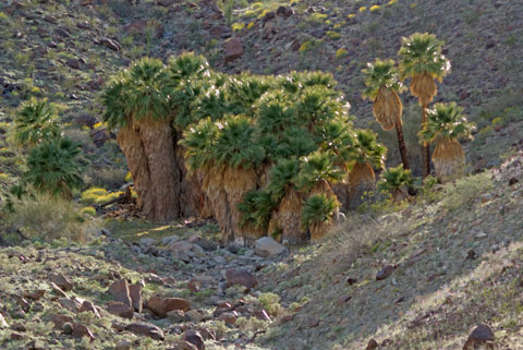
Travertine Palms
Exploring North:
Highway 371
-
Thomas MountainPoints of interest include:
- Aguanga
- Highway 79 west to Temecula, southeast to Oak Grove, Sunshine Summit,
Warner Springs, County Road S-2 to ABDSP.
- Wilson Valley Road
- Reed Valley Road. Sage. Hemet.
- Lake Riverside Estates
- Gated community on site of historic Parks ranch.
- Chihuahua Indian Reservation
- Cahuilla Casino.
- Cary Road
- Tripp Flats Road to Bautista Road. Turnoff to Cahuilla Mountain hiking
trail and Juan Diego Flats.
- Bautista Road
- Bautista Canyon.
- Anza
- Food and gas. Hamilton Museum.
- Kirby Road
- Terwilliger Valley Road. Coyote Canyon Road to ABDSP.
Horse
Canyon. Nance Canyon.
Upper
Willows .
- Pacific Crest Trail
- May be accessed by vehicle on Tule Spring Truck Trail, Coyote Canyon Jeep
Road, or Table Mountain Truck Trail.
- Pines to Palms Highway (Highway 74)
- West to Garner Valley, Thomas Mountain, Hemet, I-15, and San Juan Capistrano.
East to Pinyon Pines and Palm Desert.
|